It appears that you're running an Ad-Blocker. This site is monetized by Advertising and by User Donations; we ask that if you find this site helpful that you whitelist us in your Ad-Blocker, or make a Donation to help aid in operating costs.
Hardiness Zone Area Data for Indiana (IN)

▼ Sponsored Links ▼
▲ Sponsored Links ▲
▲ Sponsored Links ▲
State Information Data for Indiana (IN)

| Statehood | December 11th, 1816 |
| Capital | Indianapolis |
| Official Flag | 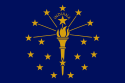 |
| Approximate Size | Total: 36,418 sq mi (94,321 km2) Width: 140 miles (225 km) Length: 270 miles (435 km) % Water: 1.5 |
| Highest Point | Hoosier Hill Point (1,257ft or 383m) |
| Counties | 92 |
| Population | 6,537,334 (2012) |
| Electoral Votes | 11 |
| State Quarter Issued | August 2nd, 2002 |
| Official Motto | The Crossroads of America |
| Official Flower | Peony |
| Official Bird | Cardinal |
| Nickname | The Hoosier State |
| Area Code(s) | 219, 260, 317, 574, 765, 812 |
| Sports | NFL: Indianapolis Colts NBA: Indiana Pacers |
▼ Sponsored Links ▼
▲ Sponsored Links ▲
▲ Sponsored Links ▲
Comments
(Related Products
▼ Sponsored Links ▼
▲ Sponsored Links ▲
▲ Sponsored Links ▲