It appears that you're running an Ad-Blocker. This site is monetized by Advertising and by User Donations; we ask that if you find this site helpful that you whitelist us in your Ad-Blocker, or make a Donation to help aid in operating costs.
Hardiness Zone Area Data for South Carolina (SC)

▼ Sponsored Links ▼
▲ Sponsored Links ▲
▲ Sponsored Links ▲
State Information Data for South Carolina (SC)

| Statehood | May 23rd, 1788 |
| Capital | Columbia |
| Official Flag | 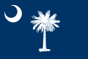 |
| Approximate Size | Total: 32,020 sq mi (82,931 km2) Width: 200 miles (320 km) Length: 260 miles (420 km) % Water: 6 |
| Highest Point | Sassafras Mt. (3,560ft or 1,085m) |
| Counties | 46 |
| Population | 4,723,723 (2012) |
| Electoral Votes | 9 |
| State Quarter Issued | May 22nd, 2000 |
| Official Motto | Dum spiro spero Animis opibusque parati (While I breathe, I hope Ready in soul and resource) |
| Official Flower | Carolina Yellow Jessamine |
| Official Bird | Great Carolina Wren |
| Nickname | The Palmetto State |
| Area Code(s) | 803, 843, 864 |
▼ Sponsored Links ▼
▲ Sponsored Links ▲
▲ Sponsored Links ▲
Comments
(Related Products
▼ Sponsored Links ▼
▲ Sponsored Links ▲
▲ Sponsored Links ▲