It appears that you're running an Ad-Blocker. This site is monetized by Advertising and by User Donations; we ask that if you find this site helpful that you whitelist us in your Ad-Blocker, or make a Donation to help aid in operating costs.

Hardiness Zone Area Data for Connecticut (CT)

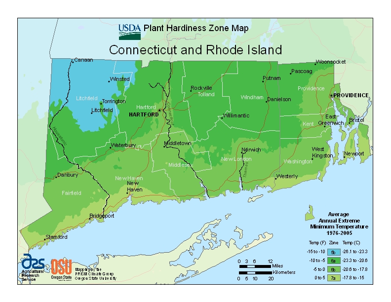
Connecticut (CT) USDA Zone Map
▼ Sponsored Links ▼
▲ Sponsored Links ▲

State Information Data for Connecticut (CT)

Hartford, Connecticut; USA
Statehood January 9th, 1788
Capital Hartford
Official Flag Connecticut (CT) Flag
Approximate Size Total: 5,543 sq mi (14,357 km2)
Width: 70 miles (113 km)
Length: 110 miles (177 km)
% Water: 12.6
Highest Point Mt. Frissell, S Slope (2,380ft or 725m)
Counties 8
Population 3,590,347 (2012)
Electoral Votes 7
State Quarter Issued October 12th, 1999
Official Motto Qui transtulit sustinet (He who transplanted sustains)
Official Flower Mountain Laurel
Official Bird Robin
Nickname The Constitution State, The Nutmeg State, The Provisions State, The Land of Steady Habits
Area Code(s) 203, 475, 860, 959
Posted By Gremelin Posted on May 8th, 2014 · Updated on April 3rd, 2019
▼ Sponsored Links ▼
▲ Sponsored Links ▲

Comments

( Posted)

Related Products

▼ Sponsored Links ▼
▲ Sponsored Links ▲
Donate Today